Introduction
The archeological, architectural and environmental surveying fields have continued to experience a lot of changes with the ever-developing technology. The latest entrant in technological advancement as far as these fields are concerned is the Laser Scanner (Curles 2000). This gadget is said to have taken the world by storm because it is practical and flexible. A variety of parameters are tested and measured, and their computation is done depending on what the researcher is interested in. The Laser Scanner is said to have the ability to work on high volumes of data as opposed to the Total Station (Haddad and Ishakat 2007). One would definitely be interested in looking at these two methods of surveying from a comparative perspective, in terms of their accuracy and efficiency, the accuracy of the outcomes of what they set out to measure and the degree to which a reduction in point could be effected before achieving a change in results.
Chen, et al. (2001) says it has been generally accepted that whenever a new form of information or technological gadget in surveying and mapping comes onto the market, the old one is usually displaced. It is thought that every new invention that comes is usually faster, more comfortable, more accurate and hence, more economical. Passing judgment of such a comparative nature demands that tests are carried out on the new invention and its performance evaluated to prove the truthfulness of the judgment. The laser scanners have been on the market for some time now, and the testing of its efficiency has been done in a variety of fields. One of the fields in which the laser scanner was tested is in volume computation, which every new technological gadget that comes up in surveying must go through. This is because most surveying activities rely on the computation of data (Gartner, et al. 1995). An invention could be said to be more effective than its predecessor if the volume of data it can compute is higher. Previous surveying activities could not allow for the surveying of an object minus touching it (Gruen and Akca 2000). The surveyor had to come close to the object before he could collect data about it. Calculation of data would also be done manually, until the invention of gadgets that could carry out reflectorless measurement and calculation of data based on the digital terrain model (DTM). The total station performs almost similar functions to those performed by the Laser scanner (Barber, et al. 2001). The two methods of surveys, however, have some differences, which will be examined during the comparison part of this paper.
Aims and Objectives
This paper aims to compare the total station and the laser as surveying equipment. This will be in the form of finding out the areas in which they differ, and those in which they perform in a similar manner. There will also be the need for investigating the degree to which measurements produced by both instruments are accurate, and the type of tasks each one of the instruments can perform. This study will also aim at establishing which one of the two instruments is cost-effective and this will be ascertained by such considerations as the duration, the cost, servicing, return on Investment among others. There will also be a comparison between the two instruments in terms of their cost efficiency and human cost. Another objective of the study is to establish if the departments such as the land survey which use these two instruments can be convinced to accept the laser scanner as the best instrument that can be used in surveying.
Methodology
This study took a rather practical approach which involved the measurement of a pile of sand using both the laser scanner and the total station. The instruments were taken from the same manufacturer, for purposes of reducing any errors that might have arisen if the two instruments had come from different manufacturers. The Leica HDS 3000 laser scanner and the Leica TPS 1200+ total station were used. The approximate volume of the pile of sand was 400 m3. The exact volume of the pile of sand was computed and three programs; the Geograf, Geo and Cyclone were used to work out the measurements from both instruments. After creating a DTM, the volume of every sphere of reference was computed by each of the programs prepared. It was observed that the results from the Geo and Geograf computation were the same, while those from the Cyclone program were different. This was done even though the calculation method and the data used was the same (Yakar, et al. 2010).
Operation of the Geo and Geograf Programs
Geograf and Geo are programs that are used for the in computation of different geological measurements. Their operation is basic with slight variations in their mechanisms and design. Geo is a program which is a microformat and is used for marking up geographical locations (WGS84) or coordinates (i.e. longitudes and latitudes) in (X) HTML (GeoSiberia 2007). This program is important in that it has specifications that make it superior in its operation and capacity to deduce and display data collected. It permits the use of parsing tools like Firefox Operating Extension (FOE) to extract locations gathered and allows them to be displayed using other mapping or website tools. In addition to this, it may also load these locations into a GPS device; it may convert them into an alternative format or aggregate or index them (Leica Geosystems 2008). There are two main requirements that are needed for the better operation of the geo program. These are:
- The number of latitudes and longitudes must be the same
- The number of decimal points used as well as the trailing zeros must be the same
Converting ordinary (X) HTML into geo micro format can be done in two basic ways:
Three classes
An example to show how this way of conversion works can be shown by the following computed example discussed below. A marked-up text of Belvide: 52.686; -2.193
Becomes: Belvide: 52.686; -2.193
When class-attribute values of ‘latitude’, ‘longitude’ and ‘geo’ are added, the following will be displayed: Belvide: 52.686; -2.193
This therefore will indicate the geo micro format for the location being considered (Belvide Reservoir) will be detected on this page using micro format parsing tools (GeoSiberia 2007).
One class
In other instances, shorthand versions may be preferred in which case latitude must appear first. For example ‘Belvide Reservoir is at 52.686; -2.193’ becomes:
Belvide Reservoir is at 52.686; -2.193.
Here it is good to note that the separator that is used must be a semi-colon.
Goegraf on the other hand, works on the principle of a transmitter emitting waves and a receiver that is tuned to detect any changes that the wave receives. In the event that the wave comes in contact with a metallic object, the theory of loosely coupled transformers requires that the emitting wave produces a current on the object (GeoSiberia 2007). The receiver picks up the signal which is then processed by radar unit incorporated on the Geograf. The unit plots a graphical mark on a vertical scale and this marks plotted are based on the time it took signals to return (Cavanaugh and Glenn 1991). This then shows a reflection of the location of the area of interest that is under study.
The Total Station was set up in a ring-like polygon with a local coordinate system. The only point that was measured of the three that were identified was the middle point. The set up of the total station was such that the tripod’s nails were the ones that stood holding it and the prism firmly together (Cavanaugh and Glenn 1991). Because of the tripod under the Total Station, the first point of view and the back point were reset. It was however not possible to force-center all the tripods.
From each point of view, the first and the following positioning point measurements were taken one after another until the whole cycle was complete. While the instrument was in a reflectorless mode, the researchers measured the points and targets on the pile of sand. From one point of view, only one target could be measured. The other things that were measured were the break line points which were marked on the sand that was piled as well as the ground it was piled on. A collimator was used in demarcating most points. Neither the structure nor the color of the piles influenced the aiming, irrespective of whether cross hairs or the collimator was used (Cavanaugh and Glenn 1991). Most of the direct aiming was at the border points because their contrast was big enough Coding was done for the points in order to differentiate between them (Cavanaugh and Glenn 1991).
This study made use of spheres in identifying the points of view. For purposes of making a clear comparison, the Laser Scanner used an independent measurement with an inaccessible pile of sand. This measurement did not make use of targets because such targets could not be measured from each of the points of view, and the spheres were considered most appropriate.
The setting of the Laser Scanner was in the same position as was the Total Station. The setting was however different from that of the Total Station because the instrument was not fastened on the nails, and it was similarly not horizontal, in order to save on time. The spheres were placed as close to the pile as possible. The scanning of each sphere was independent from the other. As a way of reducing the bulkiness of instrument, as few tripods as possible were used. The importance of this is that it saved on the time that was used on installation as well as the reducing the work involved. Two of the five spheres were mounted on lumps of magnetic bars while three were mounted on tripod stands. Four of the spheres that were used were placed in such a way that they were around the pillar and one of the spheres was placed at the centre (Leica Geosystems 2008). This sphere was put far from the point of view which happened to be in the same place. The other four spheres were never moved in the process. All the points of view were such that all the three spheres could be seen. Since the scanner was horizontally placed, there were three connecting points to steady it. This way made is possible to calculate some relevant information required: the three rotations and three translations that were required for each of the points of view referred to (Cavanaugh and Glenn 1991).
For purposes of establishing the orientation of the scanner, some images were taken. The manually drawn rectangle determined the field of view for the scanner and the use of the probe button was for measuring the object-scanner distance (Cavanaugh and Glenn 1991).
The measuring of the distance was done towards the targeting crosshairs. Consequently, the highest scanning distance was set up and the main scans done within sampling intervals of 0, 01 m by 0, 01 m. The spheres which were not part of the primary scan were scanned and fine scanned later (Cavanaugh and Glenn 1991). Various pictures were taken and for each point of view, there was the field of view.
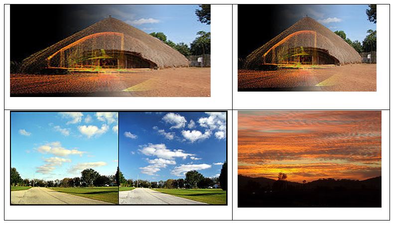
The researcher also observed some of the people who worked with the instruments at places of work. He would observe then position the instruments, take photographs, enter and calculate data and so on (See appendix 1 for some of these photos taken by the equipment). Some more information was gathered from secondary sources such as books, journals, operation manuals and so on. All these methods were the ones that were used to get data and thereafter analyze it for the purposes of writing this paper.
Instrument
Since this study sought to compare the qualities of the Laser Scanner and the Total Station, one instrument from each one of these instruments was selected to represent the whole cluster. The Leica HDS 3000 was used to examine the Laser Scanner, while the Leica TPS 1200+ was selected to represent those under the Total Station (Leica Geosystems 2008).
Leica HDS 3000 as a surveying instrument is friendly to users when it comes to taking measurements in surveys. The Leica HDS 300 has the capability to support all standard procedures applicable in surveying such as setting up of the instrument, measuring height-of-instrument as well as locating the direction of the object. The instrument has enabled users to define the limits of the scene to be scanned easily and quickly by just pressing a button found on the scanner itself. It is equipped with an improved, portable and efficient battery which makes it more flexible and friendly to use in field operations. Other characteristics of the Leica HDS 3000 include a maximum of 360˚ by 360˚ field of view, a unique double window design and a fully selectable FOV and scan density. It also has the following features:
- A digital camera which is bore-sighted to help it have the capacity to be automatically calibrated for photo overlays
- A spot size that is 6 mm
- A positional accuracy and height of instrument measurement of 6 mm
- A set up over survey point
- A flexible hot swap power system point
- A quick scan button for fast scanning.
The total station on the other hand is an optical instrument that is mostly used in contemporary surveying. In addition it is an electronic theodite integrated with an Electronic Distance Meter (EDM). The EDM has the ability to read the inclined distance from the instrument to a particular point (Cavanaugh and Glenn 1991). In the market, the greatest rival of the total station is said to be the Leica TPS 1200+ and the latter is considered to be one of the most accurate of all the reflectorless EDMs. The smallest laser dot attached to it has the capacity to measure long distances ranging over 1000 m. Because of this range, the Leica TPS 1200+ is able to measure targets which are hard-to-reach or inaccessible. This is done with true pinpoint accuracy. The Leica TPS 1200+ is fitted with telescopes that ensure that its users get the most accurate measurements particularly of the distances that are sent to the reflectors.
The Leica TPS 1200+ has complex features like accuracy, time of measurement, range and laser dots size among others. These features have given it an enviable position as the best reflectorless EDM on the market. It is self-sufficient; one does not need any other instrument to help it access missing points. The economy of Leica TPS 1200+ lies in the fact that it takes only one person to search, lock and take measurements of a point in a faster and more efficient manner than many other Total Stations in the market. The instrument is equipped with automatic target recognition ATR. This kind of an improved sensor has the capacity to accurately and reliably follow and track the prism in a way that most other Total Stations before it could. The Leica TPS 1200+ has a Power Search sensor which is unmatched which is used to lock onto the prism in the event that the locks get interrupted when the instrument is in use.
The Leica TPS 1200+ is also flexible and scalable. This allows the user to start and stop the instrument when he wants to. It is possible to customize this instrument so that it fits within the specific tasks of the user, his budget and crew (Gordon, et al. 2001). Generally, the common features of a Leica TPS 1200+ include among others; 2mm pinpoint accuracy, 1000m reflectorless range, a 6cm/50m laser dot among others. It enables the user to search, lock and measure an object with a lot of convenience. The user can also add on to the Leica TPS 1200+, plug and work in a way he wishes.
Comparison between Laser Scanner and Total Station
As earlier said, both the laser scanner and the total station are used in archaeological, architectural and environmental surveying. They are further said to belong to the reflectorless surveying instruments (Gordon, et al. 2001). In an effort to compare the ability of the two instruments in computing volume, issues such as the size of the task to be computed, the type of instruments available, the degree of accuracy demanded, the characteristics of the other already existing instruments and the economic value of the results obtained are considered.
As earlier said, a pile of sand was used in the practical part of this study. This was used to delineate the size of the object. The outcome of the experiment was that the laser scanner and the total station exhibited almost similar results; there was a kind of an overlap between them. The pile of sand had an extension of about 10-102 and, in spite of the overlap, the results indicated that the laser scanner was the best in measuring an object which had a larger size. Beinat (2001) supports this position when he says that the laser scanner has been fitted with high definition scanners which have the ability of processing voluminous data, as compared to the total station. He says that the total station is rather old as compared to the laser scanner, and the technology used is slightly inferior to that of the laser station. It can therefore be held that though both instruments have the ability to process data from a big object, the laser scanner is more modern and is therefore able to process more than the total station can.
Winkelbach and Wahl (2001) say that the total station is a typical instrument which is available in almost all engineering offices. This is because apart from having been around for long, it is also cheap and most conservative engineers would still fall back on it for routine survey work. On the other hand, the laser scanner is a bit more expensive than a total station. This instrument is mainly used for special purposes such as documenting historical data and such tasks. The scanner has not yet come to find application for routine engineering tasks in an engineering office. However, the capabilities of the Laser Scanner have not been fully established. Katsushi Lkeuchi (2001) holds the view that a scanner can do much more than what most engineering offices do with it. The laser scanner comes across as an important invention in the development and use of geodetic measuring instruments. A view is held that the total station has the ability to carry out routine computation of volume in surveying, though the Laser Scanner comes in quite handy when large volumes are to be computed (Bologna, et al. 2002).
When the total station is used to measure buildings, factories, pipes and so on, only a few points are precisely observed. A good number of them are left out of the radar. This way, the accuracy of the total station comes into question. When the terrestrial laser scanner is used on the hand, an arbitrary mass of points are observed. These points are likely to increase the accuracy of the data collected using this instrument. If the information was to be transcribed on paper, one is likely to see some kind of a regular grid. Another area of comparison between the two instruments revolves around the number of effort per point. The total station has an advantage over the laser scanner since its effort per point is higher compared to that registered by the laser scanner. One would therefore need to strain a bit in studying data registered on the total station than that on the laser scanner. Measurements made by the total station could easily be reproduced and used in other places in various forms. On the contrary, the measurements that are made by the laser scanner cannot be reproduced let alone being over-determined. It would therefore be rather problematic storing the data in any other form because such information cannot be transferred.
The information gathered using the total station instruments and representative (Ingensand, et al. 2003). This information can easily be applied to another closely related situation with some degree of accuracy. The points on the laser scanner are on the other hand non-representative. It is not possible to have such points apply to another situation, or within a different, but closely related environment. In this regard therefore, the total station seems to be having some advantage over the leaser scanner. The points on a total station are pre-marked and actually exist. They are long lasting. The points on the laser scanner are conversely non-existent. They are rather arbitrary, lacking in any form of existence. The points to be considered during the construction are chosen during the process of measurement (Jaselskis, et al. 2003). By the end of the exercise, the engineers will have known which site will be located where, which section of the road will have an incline and so on. When using the laser scanner on the other hand, the points are chosen during the post-processing period. The choice here is likely to be more subjective than objective. This is because the whole process is likely to be reduced to a contest, vested interests and so on. Generally, whereas the total station focuses its attention on the quality of the points, the laser scanner is more interested in the quality of the geometric elements. That is one more area where the two instruments differ.
In measurements in which the two instruments are used, both the single points as well as the density of the points are used to determine the accuracy of the results. Accuracy is very important if the results have to been used for research purposes (Visinintini 2002). Usually, some kind of assumed value is given and a method of measurement chosen to find out whether it is accurate, and if not, to establish which one is accurate. Though both methods can be used to give the single point accuracy, that obtained by the total station is more reliable than that of the laser scanner. It has however been generally held that the accuracy of the results of the single point measurement is not very credible. The accuracy of the value of the entire result of the DTM is more reliable. Blais, et al. (2004) however argues that the accuracy of the single point arising from the use of a laser scanner is lower than that obtained using a total station. The whole model should record a higher degree of accuracy if the points have a higher density (Blais, et al. 2004).
There are times when the measurement of the object has got to be linked to a reference net. In such a situation, the total station if the most preferable instrument to use. The laser scanner cannot be used to measure objects linked to a reference point because it cannot be aimed at an exact reference point, it (Blais, et al. 2004). A laser scanner can only measure such a measurement by the help of another instrument that is to be fitted on it so as to make the connection complete. This not only wastes time, but it is also expensive. The total station is conversely used independently, consequently saving on time and expenses.
The economic aspect of any research work cannot be gainsaid. Economy is considered by looking at the time taken to complete the project, the costs, the manpower utilized and so on. Of all the considerations, the time factor is the most important. According to Sequeira a lot of time in field work is expended on extensive manually accomplished 3D interpretation of data and objects. He says this is not in any way dependent on type of scanner itself. Large volume computations would create the need to extensively interpret data (Sequeira 1999).
Calculation can be made easy by use of the DTM (Schulz and Ingensand 2004). The DTM is an automatic method of calculation that has no need for manual manipulation, unless one is checking for errors (Soucy, et al. 1996). Time wastage by post processing of data is eliminated. The laser scanner save time and resources during data calculation since using the total station requires longer time per point which effectively translates into its (total station’s) being very expensive.
Both the laser scanner and the total station operate on some given hardware (Soucy, et al.1996). Indeed, it is this hardware that determines the capabilities that they can work on. The laser scanner and the total station can only be considered similar in their basic principles of operation. For instance, both the laser scanner and the total station can record distances as well as angles. They also involve the calculation of the measured points which are not known, to establish their coordinates. Comparatively, the scanner also is automatic and faster in working as in comparison to the total station (Soucy, et al. 1996). Though there are a number of different scanners on the market, all of them operate on an almost similar platform. Some differences might however be found between one scanner and the other because of the minor modifications that manufacturers might make on their products as a way of winning the market to their side. The conditions under which each one of them is to be used could also lead to slight variations in the instruments. For purposes of this paper, the Leica HDS 3000 will be used. Its functions could be used to apply to the other scanners, though there might be some slight variations as earlier stated.
The speed of the laser scanner is crucial when it comes to the sampling method and measuring the distance (Beraldin and Blais 2000). The laser scanner has a maximum scan rate of an upward of 4000 points. This is what one would call the instantaneous rate. The time that the instrument takes to scan an object is dependent upon the density of the scan as well as the field of view. Since columns are measured faster than rows, it is faster to measure the field of view that is higher than that which is wider. A quadratic relationship governs the change in the time taken to measure and that taken to sample. The time that is considered in this case is only the scan time. This is because a lot more time is used in scanning and measurement, transportation of the equipment, observation of points, measuring control points and so on (El-Hakim 2002). Though this is part of the time that is expended in the whole process, it is not considered material, but what authorities are interested in is the time for scanning. It can therefore be said that the speed at which the laser scanner operates is quite high in comparison to that of the total station.
Resolution could be said to be the number of dots per unit surface area. When two points are to be measured, sampling interval, which is very decisive in determining scan resolution of the image (El-Hakim 2002), is given by the vertical and horizontal axes whose values are 1, 2 mm. The sampling interval is very decisive in determining scan resolution. The local resolution is determined by the width of the beam that is emitted by the laser scanner (El-Hakim 2002). If an interval of 1– 50 m was considered, the spot would be 4 mm full width at the half height (FWHH)/6 mm. Researchers have come to agree that 10 mm is the minimum reasonably accepted sampling interval. According to Meyers (1992); the smaller the sampling interval, the smaller the value of the two measured points. The total number of points in each row relative to the column is what determines the resolution of the images (Remondino 2003). With a maximum of 20,000 points per row and 50,000 points per column, the laser scanner comes across as having the highest resolution.
Because of the high amount of radiation from the laser scanner, the performance of the instrument could easily be influenced (Remondino 2003). This is especially with regard to the range to which the instrument can gather data. The laser scanner, especially the HDS 3000 that is used for this paper has albedo, the material that can cause high amounts of radiation. The range that is given with regard to this scanner is dependent on albedo. For 90% functionality, there has to be an achievement pg 300 m, while 18% should give 134 m. What this means is that the amounts of radiation found in laser scanners can influence the rage to which it can operate.
Scanners are of two types: the camera scanner and the panorama scanner (Meyers 1992). The camera scanner cannot rotate around its axis, and can therefore only give a field of view of about 40˚ by 40˚ degrees. The HDS 3000 scanner which falls in the category of panorama scanners has filed of view of 360˚ by 270˚ horizontally and vertically respectively. Different laser scanners have different fields of view which are very specific on which conditions each can be used. It is not therefore possible for an organization to buy only one scanner because it might be handicapped when the use of the current scanner can no longer be guaranteed in a particular environment.
During scanning, there is need to combine scans from various points of view into a general coordinate system. This calls for some kind of registration to be done. Equal points from various scan worlds are used to achieve this. The equal points must of necessity be measured from varied points of view. Laser scanners are designed in such a way that such points are automatically detected in the process of scanning (El-Hakim 2007). For ease of detection during the scanning process, the targets used have high levels of reflectivity. El-Hakim further states that the scanner transmits a laser beam which has a higher intensity than that of other materials (El-Hakim 2007). There are modules in the software which give the scanner the capacity to acquire whichever targets with fine scan. The laser scanner acquires fine targets because of its high resolution which is afforded by the high technology that is used in its design and construction.
A more realistic view of the image of the object is captured by the cameras which are affixed to the scanners. In some others, the camera is needed for purposes of orientation (Lichti, et al. 2000). Using the camera in the scanner, the user is able to choose the most appropriated field of view when taking photographs of objects (See appendix 1 for some of these photos). This helps in the exact determination of the scan and consequently, the reduction in the amount of time used to scan (Lichti, et al. 2000). The user chooses which kind of resolution to have from high, medium and low, as indicated on the camera. This is easily done by simply adjusting the camera to the preferable resolution.
The time taken by a higher resolution to process the picture is more that the time taken by a lower resolution. Laser scanners can therefore be said to use cameras in order to give a good picture. The user determines which resolution the picture should have. The higher the resolution, the more the time it takes to process while the lower the resolution, the faster it takes to process the picture.
Because of the mobile nature of the work that laser scanners do, it is essential that such instruments are small; light easy to carry (Yilmaz, et al. 2009). Whereas short range scanners could meet this expectation, medium and long range scanners do not. They are rather big and heavy, making carrying it from one place to the other cumbersome, unless appropriate means of transport are sought. Most laser scanners have big dimensions. This therefore holds that if the terrain within which the laser scanner is to be used is rather unmotorable, it would be difficult to carry the bigger and heavier scanner, which might invariably have been the best suited for such an activity.
Though the scanner runs on batteries, the batteries are also part of the equipment and this has the convenience that once the batteries are charged, the user can work with it for the entire day without charging them, without the power running out (Yakar 2009). Each of the batteries can run for six hours at room temperature it could therefore take less time of it is used from outside where the temperature is cold. The lead acid battery weighs about 12 kg, making it rather problematic moving it from one place to the other. If the mains power is available, it can be connected to an external socket. The laser scanner can be used in a variety of environments even when there is no electricity because of the power back up from batteries.
The laser scanner can only be used with a lap top which has the right software. The software contains the settings that facilitate the scanning process. The visibility of the point cloud makes it possible to for it to be controlled after the scanning process. With this software, the targets can be automatically put in focus. On the whole, the laser scanner is equipped with software that enables it to perform all the functions that it is designed to perform.
As earlier stated, the total station is most common surveying instrument (Yakar 2009). The Leica TPS 1200 will be used for purposes of this paper. Distance is measured using the phase-shift method, while angles are measured by a coded glass. The angles of measurement are immediately adjusted and corrected in case in is discovered that the axis is incorrect (Yakar 2009). In order to obtain an accurate figure, the values of the corrections are calculated, and then added to all the angles. For each point, the measurements are done severally. The final value is constituted by the average of all the values measured and computed (Yakar 2009).
There is the experience of a phase shift which is dependent on the distance of the object from the device (Yakar 2009). The pulse shift can be defined as the difference between the phasing of the emitted received signal and that of the emitted signal (Yakar 2009). The problem of ambiguity in measurements is eliminated by taking and measuring various single values with different wavelengths, and then using them in the calculation of the distance of the object.
The total station can determine the coordinates of a point which is not known relative to the coordinate which is known (Lavine and Gardner 2003). This is possible so long as one is able to establish a direct sight line between the two points of reference. Measurement is taken for the distance and the angles of the total station from the points under consideration. The line of observation set up over a known point is required in order to determine the absolute location by the total station (Mayer 1999). In order to achieve this, most Total Stations are equipped with a Global Navigation Satellite System GNSS interface (Mayer 1999). The GNNS does not require a direct line of sight so as to determine the coordinates. The flipside of this technology is that it requires a longer period of time to obtain measurements of an object. Similarly, the accuracy of the vertical axis is quite poor, making the instrument t rather ineffective. This is unlike the Laser Scanner which is fast and reliable in terns of realising accuracy.
Most recent Total Station instruments have the ability to measure angles of incline by use of electro-scanning exceedingly accurate digital bar codes fixed on revolving glass cylinders or discs embedded in within the instrument itself. According to Walecki, et al. (2008) the most expensive high quality Total Stations are able to measure angles of up to 0.5 arc-second, while the more economical Total Stations which are common at construction sites have the capacity to measure angles of between 5 and 10 arc-seconds. The implication here is that just as much as there are Laser Scanners with the ability to realise various qualities of data, the different types of Total Stations are also available for various purposes. Those with the capacity for more functions are more expensive than those which are equipped to perform routine functions.
A modulated infrared or a microwave carrier signal is the one that are used to measure distance for the total station. This is generated by a tiny solid emitter which is found in the optical path of the instrument, and then reflected by a reflecting prism or the object that is being surveyed. A computer stored in the Total Station aids in the reading and interpretation of the pattern of modulation which is contained in the returning signal. The emission and reception of a multiplicity of frequencies determines the distance. Glass porro prism reflectors which emit an EDM signal are used in many of the Total Stations. An arc typical Total Station has the ability to measure distances with about 1.5 mm of accuracy over a distance of 1,500 m (Luebke 2002). Total Stations which are reflectorless have the ability to measure distances of whichever object which has a realistically light colour, and within a few hundreds of meters away.
Though the set up time is different for both instruments, the time take for actual measurement does not show unwieldy differences. For this study for example, though the laser scanner had the fastest time, the difference between the Total Station was a range of only 7 minutes. Though range might be different in different environments, but it is not quite big. The time taken for post processing activities is much smaller in Laser Scanners than the Total Station (Lee and Lee 2009). It has been established that in all the fields researched upon, the Laser Scanner seems to take a shorter period of time processing data than the Total Station in field work. When it comes to the post processing of data in mines or other places where there are objects, the Total Station works pretty faster than the Laser Scanner.
Accuracy is a very important component when it comes to assessing the effectiveness of these two instruments (Redstall 2006). The density of images obtained by the Laser Scanner, as shown by the points, is not uniform. There are areas with small points while others have large points. The regions where smaller points which are high in density are found show these are the regions that had the last point of view (Redstall 2006). The images from the Laser Scanner happen to be more accurate.
Most of the images from the Total station in similar circumstances have break lines and are blurred. If the height of two images were to be compared, that from the total station would be higher than that from the laser scanner. It cannot however be conclusively asserted that the Laser Scanner gives more accurate pictures than the Total Station because the conditions under which the images are taken must be considered.
Most models of Total stations have special features such as electronic data storage devices that are in-built and are the ones that measure distances, horizontal and vertical angles. Other models have the capacity to write the measurements onto an external data collector like a handheld computer. The software installed in the computer assists in computing data and generating the map of the surveyed area once the data has been downloaded into the computer (Song 2006).
Both the total station and the Laser Scanner can measure 3D coordinates using reflectorless method. Bonarz (2002) in fact refers to the Laser Scanner as a highly automated motorized Total Station. However, the time taken by each one of the instruments per point differs. The Laser Scanner takes a much shorter time than the Total Station. These two instruments have different levels of accuracy. The Laser Scanner happens to be less accurate than the Total Station. The Laser Scanner is said to employ simpler algorithms in the computation of its values (Teutsch 2007). This system leads to less accurate values that those of the Total Station. The other difference lies in the role played by human labour in the operations of the instruments. The operator of the Total Station chooses the points that need to be surveyed or the measured points directly. The Laser Scanner on the other hand makes a random choice of the measured points (Liu 2009).
Another area of concern between the two instruments is the rate of measuring. The Laser Scanner is said to posses a high rate of measuring than the Totals Station, whose rate of measuring is rather low (Soren 2006). The value attached to the points by the two different instruments also differs. The Laser Scanner attaches low importance to the points. It instead considers the point cloud and a random distribution of the points. The Total Station highly relies on single points which it uses to establish accuracy. The single points are usually classified in order to realise accuracy of the measurements.
Another area worth comparing between the instruments is their behaviour during surveying. The Laser Scanner does not focus on single points, but on the entire field. It takes the direction of what is referred to as the a posteriori. The Total Station on the other and focuses on only single points, in what is referred to as apriori (Guaniera 2000). Another area of concern between the two instruments is the connection of the point of view. This connection is rather complex and laborious in the Laser Scanner. The same connection in the Total Station is rather easy. What this means is that the initial set up time for the instruments is faster when using the Total Station, and slower when using the Laser Scanner. The laser Scanner can therefore be said to be time wasting, whereas the Total Station is time saving. There are usually some hidden points of the object to be surveyed. Such hidden points are usually not measured when the Laser Scanner is being used. The Total Station in the other hand has the ability to measure these hidden points because it is fitted with a semiautomatic extrapolation bar. This implies that the Total Station can be relied upon to give more details than the Laser Scanner would give. The Laser Scanner has an extra net which is not applicable in Total Stations.
Another area that could be comparatively examined is in the type of measurement. The Laser Scanner does not have a provision for manual measurement because its operations are fully automated. The Total Station on the other hand has a provision for manual measurement, though this can be avoided if it is not necessary. This is because the instrument has a provision for direct measurement. The Laser Scanner can only be remote controlled to a given extent whereas the Total Station can be remote controlled all the way. The Laser operates on a fully automated work mode (Alberto, et al. 2006). Once the points have been identified, the instrument does the rest of the work depending on the instructions given. The Total Scanner is on the other hand manual, with a few of its functions half automated.
The two instruments exhibit some differences in their handling. Handling the Laser Scanner in the post processing period is rather laborious, especially during the extraction of the corners and edges. The Total Station does not require any post processing action, especially with easy shapes. As far as meshing is concerned, the Laser Scanner does it automatically. The Total Station is able to record complex structures.
Visualization is another area in which the two instruments can be compared. Visualization in the Laser Scanner is made possible by complex structures. A lot of manual work is however needed to do this. Visualization by Total Station is done by parametric differential equalization (Maas 2008). It is a rather automatic process. As far as rendering is concerned, the Laser Scanner uses a differential equalization which is almost automatic with the 3D grid. Rendering is also done automatically with manual intervention. The Total Station is controlled by the image. Online rendering is also possible with the Total Station.
The cost of the two instruments could also be considered in terms of its acquisition and the type of work it does. The Laser Scanner is a special instrument that is not used routinely. It is however more expensive to acquire than the Total Station. The Total Station is an instrument that is universally used for surveying. One can easily say that because of its frequent use, the users of the Total Station are likely to get value for their money. As far as the handling of the instruments is concerned, the Laser Scanner is rather laborious than the Total Station, which is easy to handle. The value of field work to post processing is 1/10 for the Laser Scanner and 1/1 for the Total Station.
In measuring distance, the Laser Scanner uses the time-of-flight mode while the Total Station uses the phase-shift principle (Lerma, et al. 2007). Despite the fact that the phase-shift method achieves higher accuracies in measurement, it also has certain ambiguities which might militate against its perceived accuracy. Additionally, the amount of energy of separate pulses could be increased to match the time-of-flight method and consequently, increase its range. In order to eliminate the ambiguity associated with the Total Station because of their operating on the Phase-shift principle, a number of measurements need to be carried out. In this case, the time per point for the Total Scanner is longer than that of the laser Scanner which operates on the time-of-flight principle. The Laser Scanner is therefore most preferred for measuring longer distances than the Total Station because of its operation on the tome-of-flight mode. The Total Station with its phase-shift principle of operation is best suited for measuring shorter distances, though it is not as fast as the Laser Scanner.
Both the time-of-flight and the phase-shifty principles are referred to as electro-optical methods (Pfeifer and Briese 2007). Both measurements from the two instruments are done on a reflectorless platform, apart from the positioning of the Total Station. These instruments are prone to interference on their reflectorless range finder from obstacles and objects with have the ability to reflect laser beams, dust, fog and so on. Such obstacles have the ability to absorb the laser beam. If the object is too far from the Laser Scanner, the laser beam could also be weakened (Pfeifer and Briese 2007). Manual measurement of distance by using gadgets such as a laptop equipped with relevant programmes could help reduce these problems. Other variables that could interfere with the laser beam are atmospheric pressure, temperature, light, the incidence angle, and the material and structure of the object being scanned (Yoon, et al. 2009). These influences, referred to as symmetrical influences are found in each environment, and that they cannot be avoided. Most of these influences are the same, irrespective of whether one is using the Laser Scanner or the Total Station.
Both the Laser Scanner and the Total Station measure angles and distances in varied ways. As a result, there are differences in the levels of accuracy that each one of them is able to record for single point measurements (Nuttens, et al. 2010). The total station records a higher accuracy level for a single point than the laser Scanner. The resolution of the image obtained from the total station is lower than that of the Laser Scanner because the width of its beam is big (Pfeifer and Briese 2007).
Data provided by Laser Scanners is more exhaustive than that provided by the Total Station (Nuttens, et al. 2010). In surveying, there might be need to identify a defect in a part of a system, such as a minute leakage in burst underground fuel pipe. Laser Scanning can be done to using colour mapping. The part of the pipe that has a defect will have a different colour from the rest of the pipe. The burst can then be repaired using a solid CAD model which the Laser Scanner itself can be equipped to provide. Similar data could be obtained from a scene of crime, when the scene of crime could be reconstructed for example to show how a bullet moved from one area of the scene to the other. Though this is a gadget used on mapping, it can also be used on other related surveys. The application of the Total Station is however limited to specific areas, and cannot easily be applied elsewhere.
It has also been established that laser scanning has the ability to eliminate errors as well as omissions from survey data. Unlike the Total Station survey instrument, the laser Scanner makes a record of the physical data available in the entire space, object or environment (Boehler, et al. 2001). This minimises the possibility of some vital data being left out of the survey. Since the Laser Scanner works in a flawless manner, there is the possibility of getting accurate results during the first round of the survey hence minimising the time spend on correcting errors. The Total Station would need a number of sessions or data to be done before the correct one could be arrived at. This is rather time wasting.
The question of precision is quite important in comparing the Laser Scanner and the Total Station. The 3D Files which are produced by the Laser Scanner are closer to reality than those produced by the Total Station. This is irrespective of whether one is dealing with a landscape, an object, the interior space of a construction and so on. The various data models available in the Laser Scanner allows one to view an object from a multiplicity of vantage points sing a variety of data models. This kind of capability is missing in Total station.
Cost considerations are also important in comparing the Laser Scanner with the Total Station. The Laser scanner costs more that the Total Station when it comes to the initial cost. This cost is however mitigated by the fact that the Laser Scanner is fast, captures data accurately and can complete a project within a very short period of time. The comparatively slow mode of operation of the Total Station is likely to accumulate lots of billable time, which might work against the deceptively low initial acquisition cost.
Though the Laser Scanner has the potential of producing, processing and editing large volumes of data by use of polygon mesh models, such large volumes of data might not find enough storage space on the scanner. Such an instrument would require an additional gadget such as a computer or laptop for storage. Though large surveying and mapping concerns can spare resources to buy these computers, small ones might not. The Total Station might not have storage problems because their data is not meant for storage but for immediate consumption.
Points to be measured on a Total Station are chosen before the commencement of then measurement exercise (Yakar, et al. 2010). These points must therefore be chosen carefully or else, incorrect results will be realised. If the points chosen are insufficient, they are likely to yield inaccurate results. Yakar, et al. (2010) further says that if too many points are chosen, they are likely to be inefficient because of the amount of survey work the amount of data and the longer period of time taken in handling (Yakar, et al. 2010).
The correct choice of point is vital if the quality of the DTM is to be kept high. The art of the modelling of the terrain encompasses surveying the exact shape of the shape object or terrain using as minimum data as possible. The laser Scanner does not have such details because it does not rely on pre-selected points, but measures the entire field that comes into its view.
Practical Results for the Laser Scanner and the Total Station
A number of observations were done in order to get and over-determined value. The most likely value was computed. This kind of method is referred to as adjustment. In the first place, ‘bad errors noted in measuring elements were found by free adjustment (Amman, et al. 2001). The free adjustment level makes use of the over-determined observations. The constraints were not used in this case (Amman, et al. 2001). The setting of the direction of one point was done, while the other point was got the local coordinate. This gave the system some orientation. An observation was made that there were errors in the three directions, though this was not considered when making the final adjustment. The calculation of the final coordinates was in the framework of a given elastic adjustment which had moveable positioning points throughout that could be used as reference points for the calculations (Amman, et al. 2001). The positioning points used in this method are also movable and can be adjusted. The results from this procedure are more reliable than those from the constrained adjustment. Consider the following table obtained from Amman, et al. (2001):
Table 6: Elastic Horizontal Adjustment Results
The free adjustment was also done for height adjustment, though all observations could still have been used. It is based on the elastic adjustment that the calculation of the final heights was done (Amman, et al., 2001).
Table 2: Elastic Height Adjustment Results
The error realised by each constraint after the global and local registration was calculated (Amman, et al. 2001). A good example can be given using the Root Mean Square (RMS) where in the instance that it has an error value that is within the range of one cm for high density scanner (HDS) 3000 data then this can easily be a sign that the alignment is most likely good. Consider the following table that is obtained from Amman, et al. (2001):
Table 3: Results of the Registration
Using spheres as constraints in the first registration made it possible for the researcher to control the Laser Scanner without being affected by the adjustment of the coordinates. The targets were only used for purposes of comparing the measurements with those of the Total Station (Amman, et al. 2001). Since this research was meant to compare the two instruments, it was deemed necessary that both measurements should use a similar coordinate system. The second registration that was based on coordinates as well as the targets established many more constraints (Amman, et al. 2001).
The reduction of the point cloud led to a reduction on the ground area with every subsequent step. These results were very instrumental in determining the volume. The table below examines the effect time on the measurement. The polygon ring and the pint cloud had a mesh created for them (Amman, et al. 2001). The table below is according to Amman, et al (2001).
Table 4: Comparison of time needed to carry out an activity
The productivity level for the Laser Scanner was observed to have a higher than that of the Total Scanner. This is because the technology used by the Laser Scanner is rather superior because of its ability to acquire more points per unit time. It is for example possible to carry out a full scan together with setting up the instrument, as well as geo-referencing. This is a smaller amount of time as compared to that one would use to set up a Total Station from the initial setting up of the instrument to data capture and computation. This difference gives the Laser Scanner a head start over the Total Station.
Instruments which are equipped with systems with the ability to take measurements of several thousands of points per second allow for a spatial density in the distribution of the observed coordinates. This is much more than the traditional methods of surveying which are available. The Laser Scanner falls in the category of such instruments with high resolution. The images which it takes have more resolution and therefore more density than those taken using the Total Station. This gives the Laser Scanner an advantage over the Total Station.
There are usually problems with data capture especially if the area covered is large. Such large sites are easily taken care of by the Laser Scanner. This instrument has the ability to capture such heavy data in a very fast way hence saving time and resources. The Total Station lacks this kind of speed. Together with the fast data capture is the Laser Scanner’s ability to make more detailed presentations of the surfaces being measured. The technology used in designing and manufacturing this instrument is such that it allows for the detailed capture and measurement of surfaces. This gives it an advantage over the Total Station.
Some traditional surveying instruments have a lot of concern for specific detailed points when carrying out measurements. This is a rather time wasting and a laborious exercise. The Laser Scanner does not concern itself with the choice of break lines, points, edges or significant features of the object. It is concerned more with covering the entire regions. The Total Station on the other side lays a lot of emphasis on the details of points. This is one area where the two instruments diverge.
The total station can gather data of any object that comes close to it in its field of sight. There must be some form of physical contact between the researcher and the object. The Laser Scanner on the other hand has the ability to collect data from objects without necessarily coming in contact with them. They have for example been able to collect data from an environment which is not permissive to some cultures or those which could be considered hazardous.
Data storage after collection has continued to pose problems to surveyors after gathering it. The Laser Scanner has been able to help researchers in this case because of its ability to store data on commercial GIS systems or CADs for purposes of post processing. The Total Station has no facility for such an operation.
The Laser Scan makes it possible to join together various scans of identical points. This procedure does not only consider single points; it also considers the entire selected point cloud area. These areas are carefully and effectively covered. The Total Station, as earlier pointed out, is interested chiefly in the points than whole areas. This is likely to bring different results, however slight, in the computation of the values from the collected data.
The Laser Scanner has the ability to combine different scans collected from different positions of the scanner. There is no real need for carrying out an orientation for surveyors working in a local coordinate system. This is because the software found in the system has the ability to locate some parts from the images gathered from a number of different stations. He is then able to combine them into one. One would imagine that these two or more images originated from the same place, person or environment. The Total Station on the other hand does not have this capability and cannot therefore synchronize images.
Manpower is another area where the Laser Scanner and the Total Station could compare. With only one technical, it is possible to collect all the data needed. The good that this affords the researcher is the plenty of time that is left for him to generate management information rather than focussing on collection and processing of data. The Total Station on the other hand requires quite a number of people to perform various actions that are pertinent to its operations.
Amman, et al. (2001) argues that the Laser Scanner is a rather fast and economical instrument of creating images in surveying. The most modern of this instrument has the ability to measure and record images with a high degree of precision. Fir this purpose, one is forced to choose the what level of precision that he finds appropriate for a project because of the non-restrictive nature of the limits. Laser Scanning instruments are more practical and well fashioned to be used in recording and surveying of artefacts for cultural heritage. In addition to this, Laser Scanners does well in monitoring structural deformities compared to the Total Station despite the latter being the traditional instrument used for monitoring defects in structures. This is so because Laser Scanners have the ability to gather more information and data of a structure in a given time as compared to what a Total Station can gather in the same time line. Using the Laser Scanner, one is able to gather data from all the areas of his interest, and not just data from specific targets or chosen points. This is an indication that the laser Scanner has the ability to give the researcher a wider scope than the Total Station.
Conclusion
This essay sought to compare the Laser Scanners and the Total Station as far as a number of its applications; software and mode of operation are concerned. A number of variables that relate to these comparisons were examined. Among them were variables such as the performance of tasks, economy, cost, efficiency, time, human capital required and so on. Though a number of these variables exhibit a variety of differences between them, others do not show any differences. Similarly, whereas one instrument might be useful in one field while the other one is not, the relationship is completely altered when another scenario is considered. A Laser Scanner could for example be more costly than the Total Station in terms of acquisition. In terms of operation however, the laser Scanner might be found to be more effective in saving time, while the Total Station that had been previously billed as being cheaper might end up taking up more billable hours than the Laser Scanner.
A laser scanner saves a lot of data when used. Small programmes such as Geograf and Geo cannot easily and accurately calculate the huge amount of saved data. Even though, the Cyclone which is designed to help in the calculation of huge volumes of data still has problems computing such huge volumes. Displaying the changed view requires a lot of time. This therefore calls for a reduction in the amount of data before the commencement of calculations (Blais, et al. 2004).
After examining the effect of the reduction in the point order cloud, it occurs that this is not the best method of measuring accuracy. A reduction in the point cloud directly affects the area designed by the DTM. Increasing the size of the object being measured changes the size of the object with a similar percentage.
A laser scanner has an additional advantage in that it can be used to take cadastral survey. This is the survey that deals with creation, marking, defining and retracing or re-establishing of boundaries and sub-divisions of public land within the US. Given the complexity of cadastral survey however, there are additional equipment that are used in conjunction with laser scanners while carrying out the survey. These equipments are important in the running and developing of the photos taken as shown in appendix 2. Given the expanse of the land that should be captured in a cadastral survey, most of the time the resolution required by the equipment taking the photos surpasses that of the laser scanner although the laser scanner has fine-tuning capabilities that bring proper and required finishing to the photos taken (Curles, 2000). Given the incredible capabilities that a laser scanner has, the results and data that is collected by the laser scanner are acceptable and approvable by government agencies like the US Department of the Interior Bureau of Land Management (Curles 2000).
On the whole, though the Laser Scanner and the Total Station appear to have some differences in their structure and mode of operation, there are some very important areas where they are similar. It is not however easy to look at one of the instruments as being completely perfect as compared you the other. There are merits and demerits associated with each one of them. There are for example areas where the Laser Scanner can work better than the Total Station, just as much as there are those where the Total Station can work better than the laser Scanner. It is incumbent upon the surveyor or any other person using any of the two instruments to pick on one that best suits the kind of activities he wishes to perform.
References
Alberto, G. et al., 2006. Photogrammetry and Ground-based Laser Scanning: Assessment of Metric Accuracy of the 3D Model of Pozzoveggiani Church, Journal of Geomapping, 32 (7), pp. 68-75.
Amann, M -C, Bosch, T, Lescure, M., Myllyla, R and Rioux, M., 2001. Laser Ranging a Critical Review of Usual Techniques for Distance Measurement. In, Optical Engineering, 40(1), pp. 10-19.
Barber, D. et al., 2001. Laser Scanning and Photogrammetry: 21st Century Metrology. Proceedings of the Surveying and Documentation of Historic Buildings – Monuments – Sites Traditional and Modern Methods. Potsdam: CIPA 2001 International Symposium.
Beinat, A. and Crosilla, F., 2001. Generalized Procrustes Analysis for size and shape 3- D object Reconstruction. In Gruen, Kahmen (Eds), V Optical 3-D Measurement Techniques. Vienna, Austria: Global Publishers.
Beraldin, J. and Blais, F., 2000. Active 3D sensing. Scuola Normale Superiore Pisa. Quaderni: Centro di Ricerche Informatiche per I Beni Culurali.
Blais, F. et al., 2004. “Accurate 3D acquisition of freely moving objects”. 2nd International Symposium on 3D Data Processing, Visualization, and Transmission, 3DPVT 2004, Thessaloniki, Greece. Los Alamitos: CA IEEE Computer Society.
Boehler, W., Heinz, G. and Marbs, A., 2001. The potential of non-contact close range laser scanners for cultural heritage recording, In: CIPA, Working group VI, pp. 431-436.
Bologna, R. et al., 2002. Automatic registration of 3D views, Proceedings of the ISPRS Comm. V Symposium “Close Range Imaging-Long-Range Vision”, Greece.
Bonarz, F., 2002. Surveying and Mapping Instruments. New York: Routledge.
Cavanaugh, B.F. and Glenn Bird, S.J., 1996. Surveying principles and applications (4 ed.). New York: Prentice Hall.
Chen, F. et al., 2000. Overview of three-dimensional shape measurement using optical Methods. Optic. Eng., 39, pp. 10-22.
Curles, B., 2000. From Range Scans to 3D Models. ACM SIGGRAPH Computer Graphics, 33 (4), pp. 38–41.
El-Hakim, S.F., 2002. Semi-automatic 3D reconstruction of occluded and unmarked surfaces from widely separated views. Proc. ISPRS Comm. V Sym., Corfu, Greece, pp. 143-148.
El-Hakim, S.F. et al., 2003. Visualization of highly textured surfaces, Proc. VAST 2003. Brighton, UK, Nov., pp. 231-240.
Gartner, H. et al., 1995. New, high efficient, binary codes for structured light methods. SPIE Proceedings, 2599, pp. 4-13.
Gordon, S. et al., 2001. Application of a High- Resolution, Ground-Based Laser Scanner for Deformation Measurements, Session on New techniques in monitoring surveys, 10th FIG International Symposium on Deformation Measurements. California, USA: Orange.
Gruen, A. and Akca, D., 2004. Least squares 3D surface matching. Int. Arch. of Photogrammetry and Remote Sensing, Vol. 34(5/W16). Germany: Dresden.
Guaniera, A. et al., 2000. Digital photogrammetry and laser scanning in cultural heritage survey. Padova: University of Padova.
Haddad, N. and Ishakat, F., 2007. 3D Laser Scanner and Reflectorless Total Station: A Comparative Study of the Slots of El-Khazneh at Petra in Jordan. Athens, Greece: International CIPA Symposium.
Ingensand, H. et al., 2003. Performances and Experiences in Terrestrial Laser scanning, Proceedings of the 6th Conference on Optical 3D Measurement Techniques. Zurich.
Jaselskis, E. et al., 2003. Pilot Study on Improving the Efficiency of Transportation Projects Using Laser Scanning, Final Report, Centre for Transportation Research and Education, Iowa State University. USA: Midwest Transportation Consortium.
Katsushi, L., 2001. “Modeling from Reality”. 3rd International Conference on 3-D Digital Imaging and Modeling: Proceedings, Quebec City, Canada. Los Alamitos: CA IEEE Computer.
Lavine, A. and Gardner, J., 2003. Total station geologic mapping: an innovative approach to analyzing surface-faulting hazards. Sydney: Elsevier Sciences.
Lee, S. and Lee, J., 2009. Comparison of terrestrial laser scanner with Digital aerial photogrammetry for extracting Ridges in the rice paddies. Survey Review, 41(313), pp. 253-267.
Leica Geosystems, A.G., 2008. Leica Scan Station 3D laser scanner with total station features. Switzerland: Heerbrugg.
Lerma, G. et al., 2007. Ed., Application of Terrestrial Laser Scanning for Risk Mapping. Valencia: Editorial Universidad Politecnica de Valencia.
Lichti, D.D., Stewart, M.P., Tsakiri, M. and Snow, A.J., 2000. Calibration and testing of a terrestrial laser scanner. Int. Arch. of Photogrammetry and Remote Sensing, XXXIII, (Part B5), pp. 485-492.
Liu, S., 2009. The Point of View and the Field of View. Washington: Brooks Publishers.
Luebke, D., 2002. The Total Stations in Geomapping. Canada: Geobooks.
Maas, H.G., 1992. Robust Automatic Surface Reconstruction with Structured Light. Int. Archives of Photogrammetry and Remote Sensing, 24(B5), pp.102-107.
Mayer, R., 1999. Scientific Canadian: Invention and Innovation from Canada’s National Research Council. Vancouver: Raincoast Books.
Meyers, D., et al., 1992. Surfaces from contours. ACM Transactions on Graphics, 11(3), pp. 228–258.
Nuttens, T, et al., 2010. High resolution terrestrial laser scanning for tunnel deformation measurements: Facing the Challenges – Building the Capacity. Sydney: Elsevier.
Pfeifer, N. and Briese, C., 2007. Laser scanning – Principles and Applications. Vancouver: Raincoast Books.
GeoSiberia, 2007. International Exhibition and Scientific Congress. Padova: University of Padova.
Redstall, M., 2006. Accurate terrestrial laser scanning from a moving platform. Geomatics World, 21 (10), pp. 28- 30.
Remondino, F., 2003. 3D reconstruction of static human body with a digital camera. In El-Hakim, G. et al 2008, Videometrics VII. Proc. of SPIE Electronic Imaging, 50 (13), pp. 38-45.
Sequeira, V. et al., 1999. Automated reconstruction of 3D models from real environments. Canada: ISPRS Journal for Photogrammetry and Remote Sensing.
Schulz, T. and Ingensand, H., 2004. Terrestrial Laser Scanning – Investigations and Applications for High Precision Scanning. Athens, Greece: FIG Working Week.
Song, Z., 2006. The Many Faces of the Total Station. New York: McGraw Hill.
Soren, L 2006, Motion control and data capturing for laser scanning with an industrial robot. Robotics and Autonomous Systems, 54 (10), pp. 453-460.
Soucy, M., et al., 1996. Sensors and algorithms for the construction of digital 3-D colour models of real objects. Proceedings of the IEEE International Conference on Image Processing, Lausanne, Suisse, 2 (II), pp. 409-412.
Teutsch, C., 2007. Model-based Analysis and Evaluation of Point Sets from Optical 3D Laser Scanners. Journal of Survey and Geomapping, 6 (34), p. 41.
Visintini, D., 2002. Integrated Techniques for Low-Cost Surveying of Urban Areas. ISPRS Commission III, Symposium, 9 (13), p. B-287 ff.
Walecki, W. et al., 2008. Fast in-line surface topography metrology enabling stress calculation for solar cell manufacturing for throughput in excess of 2000 wafers per hour. Meas. Sci. Technol, 19 (2), pp. 025302.
Winkelbach, S. and Wahl, F.M., 2001. Shape from 2D Edge Gradient. Pattern Recognition. Lecture Notes in Computer Science, 2 (1), p. 91.
Yakar, M., 2009. Digital Elevation Model Generation by Robotic Total Station Instrument. Exp. Tech, 33(2), pp. 52-59.
Yakar, H. et al., 2010. Close range photogrammetry and robotic total station in volume calculation. International Journal of the Physical Sciences, 5 (2), pp. 086-096.
Yilmaz, H. et al., 2009. Monitoring of Corrosion in Fairy Chimney by Terrestrial Laser Scanning J. Int. Environ. Appl. Sci., 4(1), pp. 86-91.
Yoon, J. et al., 2009. Feature extraction of a concrete tunnel liner from 3D laser scanning data. NDT&E International, 42 (3), pp. 97-105.
Appendix 1